
The corporate headquarters for FujiXerox
I work for FXPAL, a Silicon Valley research lab that’s owned by FujiXerox, a large Japanese company. Recently, I spent a week working with my colleagues in Yokohama. I was able to add enough time to the end of the trip to attempt the roughly 55 kilometer run from a seaside park to the top of Mount Fuji and then back down the mountain to a bus stop. As far as ultra-running goes, 55K isn’t a huge distance. This course is unique in that there is almost nothing flat or downhill until the 45k mark at the top of the mountain. As luck would have it, the only day I had to attempt the run was during the remnants of a typhoon.

On the train to Fuji no Kuni Tagonoura Minato Park.
Summiting Mt. Fuji is yet another one of those ‘bucket list” things people of a certain age feel compelled to do. Apparently I’m of a certain age, because I’ve ticked off two of these “life experiences” this year. At least this nonsense is cheaper than a Corvette.
I wanted to find a route to and up Mt. Fuji that would let me experience as much of the area as possible. I followed the "The Mt. Fuji Tourism Climbing Route 3776" from a seaside park to the top of Mount Fuji. It’s about 30 (unrelentingly uphill) miles from the start to the top, with another 5 or 6 miles back down the mountain to a bus stop. This is meant to be a four day trek, but my goal was to finish the course, and get back to my hotel, in under one day.

A ham, cheese, egg, noodle, fried chicken on white bread sandwich.
I arrived at the Shin-Fuji Train station at about four o'clock in the afternoon. After a hearty lunch I caught a cab to Fujinokuni Tagonoura Minato Park, the start of my run. The rain made it hard to see, but this is a pretty park with nice views of Tagonoura bay and a cool old boat.

One of the attendants at the park gave me the best possible send off.
Finding the park was easy enough, actually finding the starting point for the 3776 route was harder. After explaining myself with the help of Google Translate and a picture of the 3776 logo, this park attendant helped me find the starting point. After sizing up my gear he also gave me a cloth to blot sweat and rain from my head. Running long distances alone is a strange thing to do... it's hard to express how meaningful that gesture became late at night when I was tired, wet and just a little bit lost.

Typhoon Cimaron
I should probably spend a moment on the weather. It was generally pretty bad. The start was hot and humid with sporadic rain showers. That gave way to rain and very strong winds. Below 5-6 thousand feet it was pretty standard bad weather. As I began to really climb the mountain, things took a noticeable turn. Besides being much colder, the wind was now capable of pulling small objects out of my hand. I ended up using my trekking poles for stability. Luckily, the worst of it came in waves, with periods of relative calm in between.
I don't have a lot of pictures from the first 10-15 miles of the run. Partly because I was making good time, partly because I took them with a GoPro that was lost (more on that later).
Once it got dark and I slowed down, I did take a few pictures with my phone—with the intention of sharing them on Instagram. I’m glad that I did. Otherwise, I wouldn’t have any pictures at all and people would just have to take my world for it that I made it to the top of Mt. Fuji.

Running at night.
I covered much of this run at night. My goal was to get to the top of the mountain by dawn. It's true that you miss a lot of the sights at night. However, there is a beauty in the way the world is revealed to you in shallow vignettes. You can peer as far as your lights will allow, and no farther. Everything else is a mystery. This was especially true on this trip because of the rain and fog. There were times that I could barely see my own feet on the trail.
Keep moving...
I have no idea what this sign actually says. In my imagination it said "You aren't even close to the top". I was still about 19 KM from the summit at that point.

3667 Course markings.
The first third or so of the 3776 course is very easy to follow because of these markers. They were a huge confidence boost. Nearly every turn was well marked. Until they weren't. At some point these signs just stopped appearing.

He looks too cute to maul me.
After seeing this sign, I heard a terrifying scream. Like legitimately scary. Later, I was told that a local deer makes this noise.

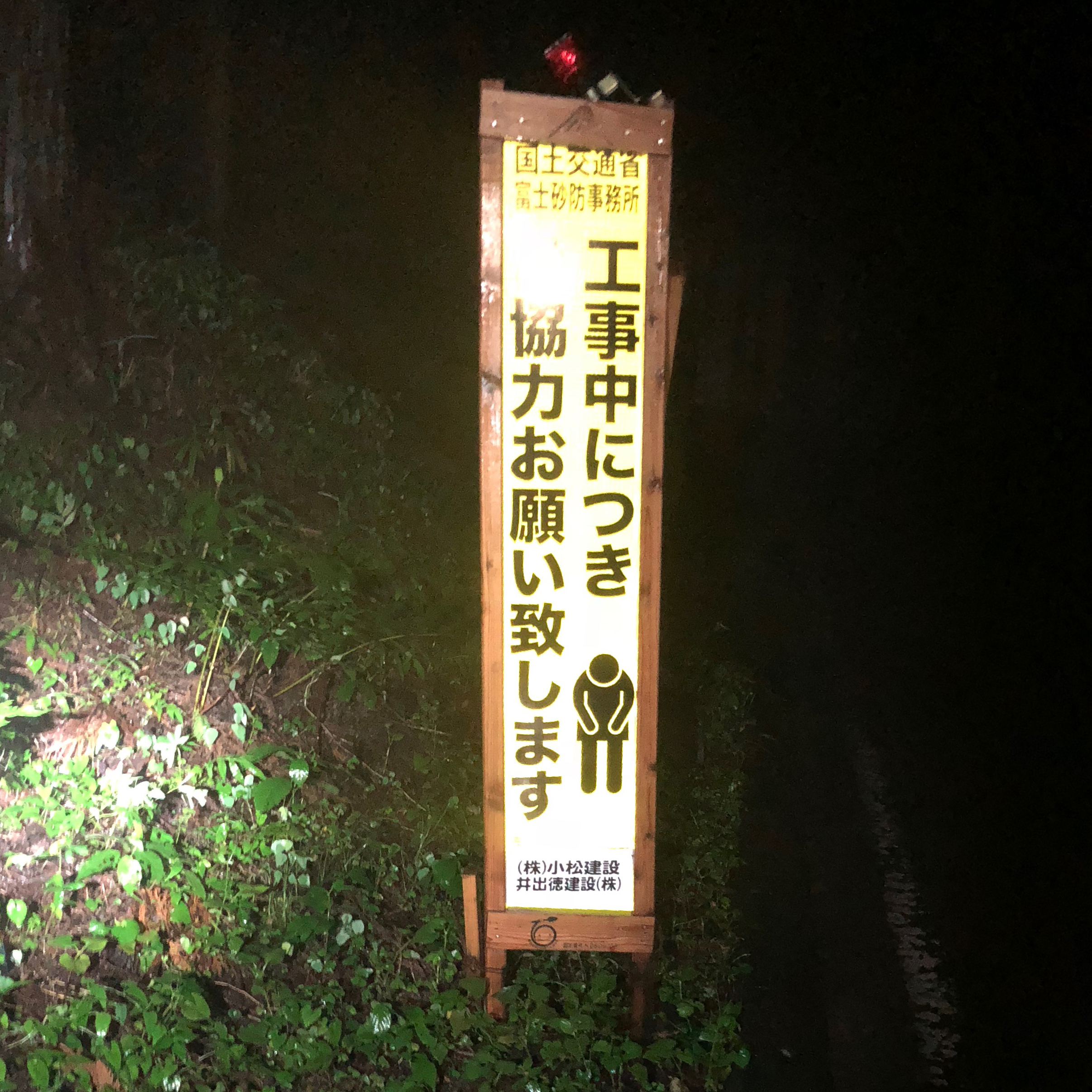
I completely agree with this sign.
I filled up my hydration pack at the Green Camp Site. This turned out to be a really good idea. A few miles later, the road section ends very abruptly. The slow climb to the sixth station was on the steep and technical Mt. Fuji Natural Recreation Forest trail. I'm sure the rain made it worse, but I was surprised by how difficult this section actually was. Unfortunately, I don't have any pictures from this section. They were all taken with the GoPro that was lost. The wind and rain were intense. The camera was literally ripped from my hand by a particularly powerful gust. When I'm running I have a habit of picking up trash, I did it on this run too. Hopefully that goes some small way towards balancing the ecological scales. Mount Fuji is a beautiful place, I feel terrible that I've diminished it in a small way. Hopefully, some lucky hiker finds and keeps the camera.
I added an in-line filter to my hydration pack. Because of this, I was comfortable refilling my hydration pack with water from a rain catch at the sixth station. It was still dark when I arrived and the vending machines were turned off. I didn’t expect this. I had to make do with the food I was carrying for much longer than I had anticipated. After a hot and humid day, the air was getting noticeably colder. I wore my wool base layer from this point on.
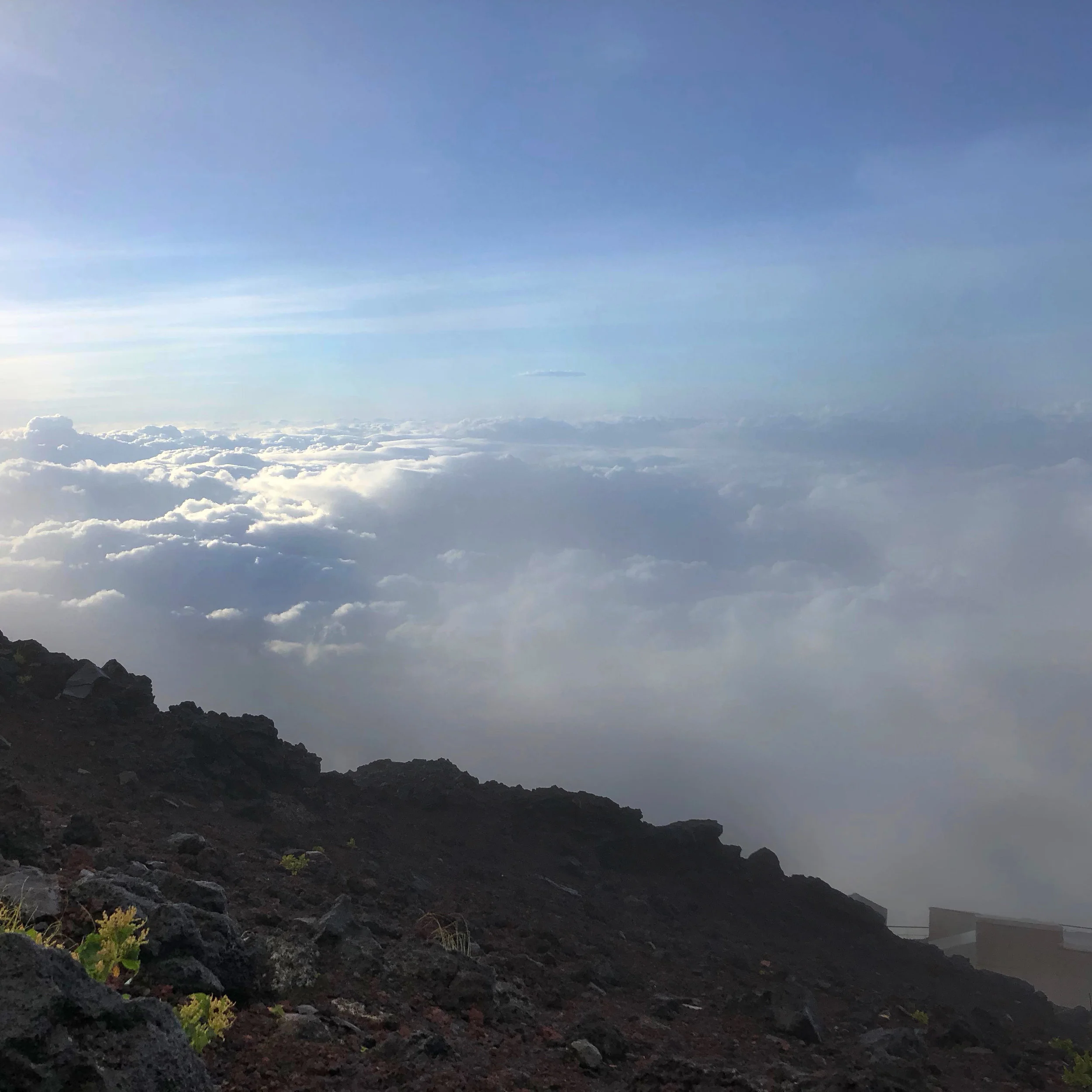
Above the clouds.
It wasn't until after sunrise that I got a sense of how high I was. The view from the various stations above the sixth are amazing.

A broken Torrii Gate
The intense winds from Typhoon Cimaron ripped this large wooden gate apart. Visitors push coins and military pins into gate like this. The ground was littered with these offerings. Near the summit, trail markings became extremely easy to follow. There were arrows every few feet and very few places to make a wrong turn.

Yes!
The stations began to open as I reached the top of the summit. I was able to buy some breakfast at station 8. I was still the only person climbing when I reached the 200 meters to go sign.

Closer...
The weather took another turn for the worse as I approached the summit. Visibility was so poor that I couldn't actually see my goal in the distance.

At the summit.
I was almost surprised when I actually reached the summit. I walked around a bit, but the visibility was so bad that I couldn't really see most of the sights.

A stranded family.
I met a family that told me that they had been stranded at these mountain-top huts for three days because of the weather. It was pretty miserable & I'm not sure that I'd want to hike through a mountain top storm with my child. But still, three days? Later, I found out that the busses and shuttles that casual hikers use weren’t running during the storm. Maybe that’s why they were stuck waiting? Anyway, they were very nice, as was the guy who was chain smoking and taking our pictures.

The weather improved as the sun rose.
As luck would have it, the weather got finally better just as my journey came to an end. The fog rose and revealed the beautiful Japanese landscape.
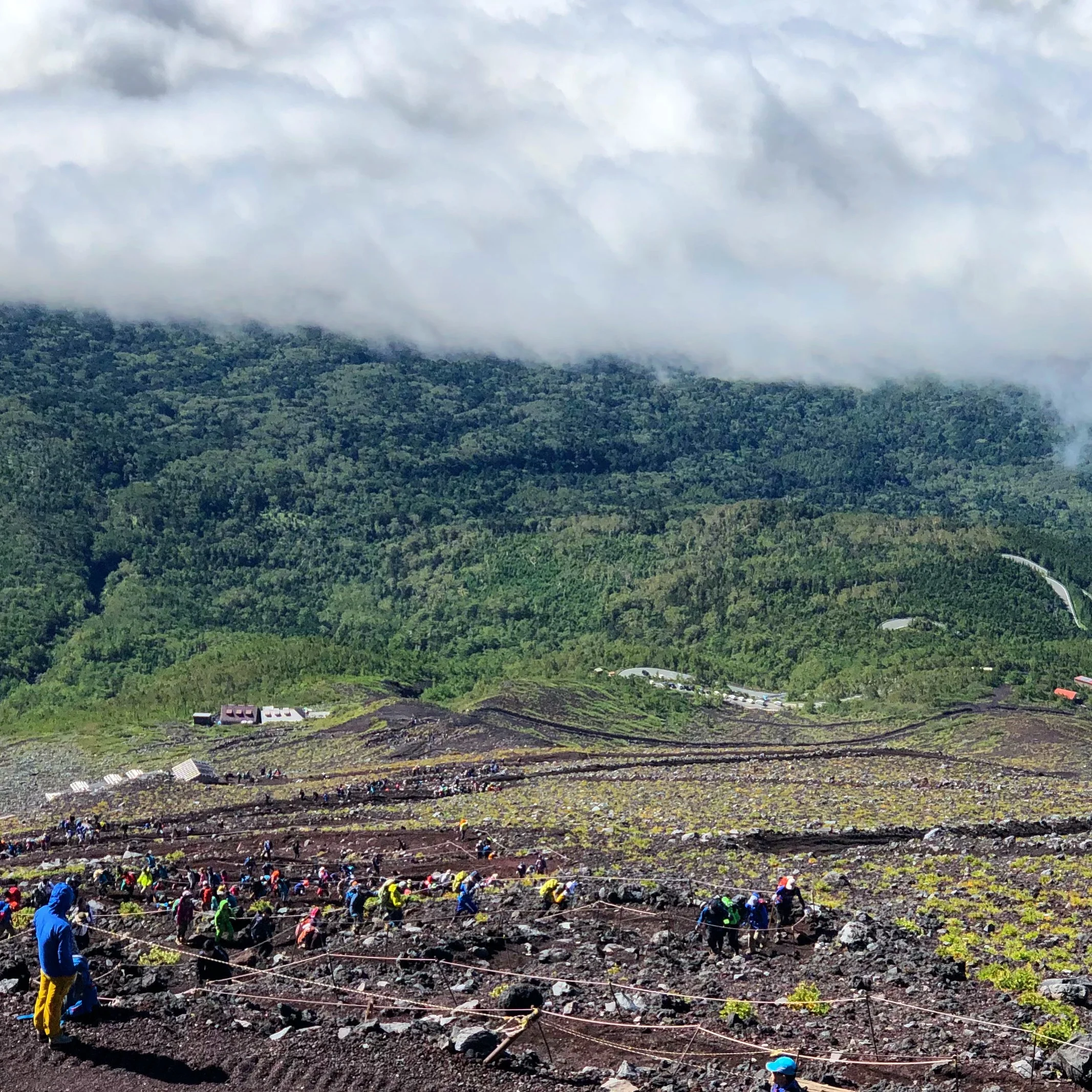
Hundreds of hikers making their way up Fuji-san.
Apparently, hundreds of people were waiting at station five for the weather to improve. Once it did, they all began to hike up the trail at once. It's hard to see in this picture, but there is hardly a section of trail without crowds of people hiking.

The remnants of the storm clinging to the summit.
As the trail became easier the weather became nicer. It was blue skies and sunshine by the time I approached station five, and the bus that would take me to the train that would take me my hotel.

Train Schedule
Mount Fuji wasn't done with me yet! I took a comfortable bullet train from my hotel directly to the start of my run. That train wasn't running for my return trip. Instead I had to change trains several times. Some of these trains were local enough to have absolutely no English spoken or written. Luckily Japanese trains are so punctual that I could use the schedule to know when a stop was approaching. Still, that was way more work than I was expecting to do.

Maserated skin.
By the time I got to finally take my shoes off, my skin had been wet for nearly 24 hours. This takes it's toll. I didn't have any significant blisters, but the wet skin was painful, especially as the adrenaline wore off.

Ready for bed.
I spent the night at a 9 hours capsule hotel. This was perfect. I showered and went straight to sleep.

Souvenirs.
And then I flew home. I'm glad that I went on this journey. The Mt. Fuji Tourism Climbing Route 3776 is meant to be a four day undertaking. Doing it in less than one day is a physical challenge, but maybe not the best way to experience Fuji. The entire area is beautiful. The bus I took covered much of the course I ran. I missed many beautiful sights by running so much of the course at night.

My GPS route from Strava.
Arigatō, Fujisan!
UPDATE:

Finisher’s pin and certificate
At the start of my attempt, I submitted a “challenge plan”. I was a little worried because my plan was a bit different than the trek the “Fujisan Tourism & Communication Bureau” had in mind. I also submitted my proof of completion. Again, I wasn’t sure if my version of the trek would be counted as an official finish or not. It was! A few weeks after I got home this certificate and finisher’s pin arrived in the mail. This really is a fantastic course! Go and enjoy all or some of it at whatever pace works for you.
Mount Fuji, is a beautiful place. All the more so, because of the mountain’s rich history and cultural significance. Temples and shrines surround and dot the mountain. These are integrated into the experience of climbing Mt. Fuji.